- Scopus
- Chinese Science Citation Database (CSCD)
- A Guide to the Core Journal of China
- CSTPCD
- F5000 Frontrunner
- RCCSE
| Citation: |
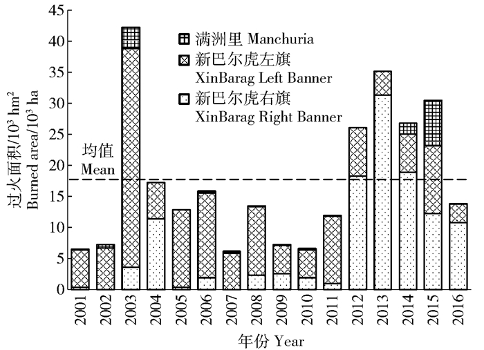
Gong Da-peng, Kang Feng-feng, Liu Xiao-dong. Spatial and temporal distribution patterns of grassland fire and its response to meteorological factors in XinBarag Prairie of northwestern China[J]. Journal of Beijing Forestry University, 2018, 40(2): 82-89. DOI: 10.13332/j.1000-1522.20170402

|
| [1] |
雒瑞森.全球火格局的时空变异及其机理分析[D].杭州: 浙江大学, 2013. http://d.wanfangdata.com.cn/Thesis/Y2405202
Luo R S. Global analysis of spatial and temporal variations of fire patterns and the mechanisms [D]. Hangzhou: Zhejiang University, 2013. http://d.wanfangdata.com.cn/Thesis/Y2405202
|
| [2] |
Li Z, Fraser R, Jin J, et al. Evaluation of satellite-based algorithms for fire detection and mapping within North America[J/OL]. Journal of Geophysical Research, 2003, 108(D2): 4076 [2017-05-11]. www.researchgate.net/publication/24611. DOI: 10.1029/2001JD001377.
|
| [3] |
周广胜, 卢琦.气象与森林草原火灾[M].北京:气象出版社, 2009.
Zhou G S, Lu Q. Meteorology and forest-grassland fire[M]. Beijing: China Meteorological Press, 2009.
|
| [4] |
陈世荣.草原火灾遥感监测与预警方法研究[D].北京: 中国科学院研究生院, 2006. http://d.wanfangdata.com.cn/Thesis/J008377
Chen S R. A study of grassland fire monitoring and early warning methods using remote sensing[D]. Beijing: Chinese Academy of Sciences, 2006. http://d.wanfangdata.com.cn/Thesis/J008377
|
| [5] |
胡海清, 李楠, 孙龙, 等.伊春地区森林火灾时空分布格局[J].东北林业大学学报, 2011, 39(10):67-70. doi: 10.3969/j.issn.1000-5382.2011.10.019
Hu H Q, Li N, Sun L, et al. Spatial and temporal distribution patterns of forest fires in Yichun, Heilongjiang Province[J]. Journal of Northeast Forestry University, 2011, 39(10):67-70. doi: 10.3969/j.issn.1000-5382.2011.10.019
|
| [6] |
马楠楠, 张彦雷, 李建, 等.黑龙江呼玛县森林火灾时空分布特征[J].东北林业大学学报, 2016, 44(5):20-23. doi: 10.3969/j.issn.1000-5382.2016.05.005
Ma N N, Zhang Y L, Li J, et al. Spatial and temporal distribution characteristics of forest fire in Huma County of Heilongjiang Province[J]. Journal of Northeast Forestry University, 2016, 44(5):20-23. doi: 10.3969/j.issn.1000-5382.2016.05.005
|
| [7] |
杨广斌, 唐小明, 宁晋杰, 等.北京市1986—2006年森林火灾的时空分布规律[J].林业科学, 2009, 45(7):90-95. doi: 10.3321/j.issn:1001-7488.2009.07.015
Yang G B, Tang X M, Ning J J, et al. Spatial and temporal distribution pattern of forest fire occurred in Beijing from 1986 to 2006[J]. Scientia Silvae Sinicae, 2009, 45(7):90-95. doi: 10.3321/j.issn:1001-7488.2009.07.015
|
| [8] |
Seol A, Lee B, Chung J. Analysis of the seasonal characteristics of forest fires in South Korea using the multivariate analysis approach[J]. Journal of Forest Research, 2012, 17(1):45-50. doi: 10.1007/s10310-011-0263-8
|
| [9] |
郑琼, 邸雪颖, 金森.伊春地区1980—2010年森林火灾时空格局及影响因子[J].林业科学, 2013, 49(4):157-163. http://www.cnki.com.cn/Article/CJFDTotal-LYKE201304026.htm
Zheng Q, Di X Y, Jin S. Temporal and spatial patterns of forest fires in Yichun Area during 1980-2010 and the influence of meteorological factors[J] Scientia Silvae Sinicae, 2013, 49(4):157-163. http://www.cnki.com.cn/Article/CJFDTotal-LYKE201304026.htm
|
| [10] |
王明玉, 孙龙, 舒立福, 等.林火在空间上的波动性及其区域化行为[J].林业科学, 2006, 42(5):98-103. http://d.old.wanfangdata.com.cn/Periodical/lykx200605018
Wang M Y, Sun L, Shu L F, et al. Fluctuation of forest fire in spatial space and their regional behavior[J] Scientia Silvae Sinicae, 2006, 42(5):98-103. http://d.old.wanfangdata.com.cn/Periodical/lykx200605018
|
| [11] |
苏立娟, 何友均, 陈绍志. 1950—2010年中国森林火灾时空特征及风险分析[J].林业科学, 2015, 51(1):88-96. doi: 10.3969/j.issn.1006-1126.2015.01.018
Su L J, He Y J, Chen S Z. Temporal and spatial characteristics and risk analysis of forest fires in China from 1950 to 2010[J] Scientia Silvae Sinicae, 2015, 51(1):88-96. doi: 10.3969/j.issn.1006-1126.2015.01.018
|
| [12] |
贺宝华, 陈良富, 陶金花, 等.基于观测几何的环境卫星红外相机遥感火点监测算法[J].红外与毫米波学报, 2011, 30(2):104-108. http://d.old.wanfangdata.com.cn/Periodical/hwyhmb201102002
He B H, Chen L F, Tao J H, et al. A contextual fire detection algorithm based on observation geometry for HJ-1B-IRS[J]. Journal of Infrared and Millimeter Waves, 2011, 30(2):104-108. http://d.old.wanfangdata.com.cn/Periodical/hwyhmb201102002
|
| [13] |
Liu W, Wang L, Zhou Y, et al. A comparison of forest fire burned area indices based on HJ satellite data[J]. Natural Hazards, 2016, 81(2):1-10. http://www.wanfangdata.com.cn/details/detail.do?_type=perio&id=765ea3bd943a5ed6b87dfda99e70d31c
|
| [14] |
Liu M, Zhao J, Guo X, et al. Study on climate and grassland fire in HulunBuir, Inner Mongolia Autonomous Region, China[J]. Sensors, 2017, 17(3):616. doi: 10.3390/s17030616
|
| [15] |
Araújo F M D, Ferreira L G, Arantes A E. Distribution patterns of burned areas in the Brazilian Biomes: an analysis based on satellite data for the 2002-2010 Period[J]. Remote Sensing, 2012, 4(7):1929-1946. doi: 10.3390/rs4071929
|
| [16] |
邓欧, 李亦秋, 冯仲科, 等.基于空间Logistic的黑龙江省林火风险模型与火险区划[J].农业工程学报, 2012, 28(8):200-205. doi: 10.3969/j.issn.1002-6819.2012.08.031
Deng O, Li Y Q, Feng Z K, et al. Model and zoning of forest fire risk in Heilongjiang Province based on spatial Logistic[J].Transactions of the Chinese Society of Agricultural Engineering (Transactions of the CSAE), 2012, 28(8): 200-205. doi: 10.3969/j.issn.1002-6819.2012.08.031
|
| [17] |
何诚, 巩垠熙, 张思玉, 等.基于MODIS数据的森林火险时空分异规律研究[J].光谱学与光谱分析, 2013, 33(9):2472-2477. doi: 10.3964/j.issn.1000-0593(2013)09-2472-06
He C, Gong Y X, Zhang S Y, et al. Forest fire division by using MODIS data based on the temporal-spatial variation law[J]. Spectroscopy and Spectral Analysis, 2013, 33(9):2472-2477. doi: 10.3964/j.issn.1000-0593(2013)09-2472-06
|
| [18] |
贾旭, 高永, 齐呼格金, 等.基于MODIS数据的内蒙古野火时空变化特征[J].中国生态农业学报, 2017, 25(1):127-135. http://d.old.wanfangdata.com.cn/Periodical/stnyyj201701016
Jia X, Gao Y, Qihugejin, et al. MODIS-based spatial-temporal distribution of wildfire in Inner Mongolia[J]. Chinese Journal of Eco-Agriculture, 2017, 25(1): 127-135. http://d.old.wanfangdata.com.cn/Periodical/stnyyj201701016
|
| [19] |
Zhu Q, Rong T, Sun R. A case study on fractal simulation of forest fire spread[J]. Science in China, 2000, 43(1):104-112. doi: 10.1007/BF02903854
|
| [20] |
Ponomarev E I, Kharuk V I, Ranson K J. Wildfires dynamics in Siberian larch forests[J]. Forests, 2016, 7(6):125. http://www.wanfangdata.com.cn/details/detail.do?_type=perio&id=forests-07-00125
|
| [21] |
Csiszar I, Fraser R, Hao W M. Development and analysis of a 12-year daily 1-km forest fire dataset across North America from NOAA/AVHRR data[J]. Remote Sensing of Environment, 2007, 108(2):198-208. http://www.wanfangdata.com.cn/details/detail.do?_type=perio&id=e8edc4e3e0025153aa2ff917dc0f68f6
|
| [22] |
Li Z, Nsdon S, Cihlar J, et al. Satellite-based mapping of Canadian boreal forest fires: evaluation and comparison of algorithms[J]. International Journal of Remote Sensing, 2000, 20(16):3071-3082. doi: 10.1109-TCPMT.2011.2162069/
|
| [23] |
Femandez A, Illera P, Casanova J L. Automatic mapping of surfaces affected by forest fires in Spain using AVHRR NDVI composite image data[J]. Remote Sensing of Environment, 1997, 60(2):153-162. http://www.wanfangdata.com.cn/details/detail.do?_type=perio&id=2743fdb173a8e16382e3704243c4ec03
|
| [24] |
Fraser R H, Li Z, Cihlar J. Hotspot and NDVI differencing synergy (HANDS): a new technique for burned area mapping over boreal forest[J]. Remote Sensing of Environment, 2000, 74(3):362-376. doi: 10.1016/S0034-4257(00)00078-X
|
| [25] |
Leeuwen W J D V, Huete A R, Laing T W. MODIS vegetation index compositing approach[J]. Remote Sensing of Environment, 1999, 69(99):264-280. doi: 10.1016-S0034-4257(99)00022-X/
|
| [26] |
Barbosa P M, Grégoire J M, Pereira J M C. An algorithm for extracting burned areas from time series of AVHRR GAC data applied at a continental scale[J]. Remote Sensing of Environment, 1999, 69(3):253-263. doi: 10.1016/S0034-4257(99)00026-7
|
| [27] |
Martin M P, Chuvieco E. Mapping and evaluation of burned land from multi-temporal analysis of AVHRR NDVI images[J]. EARSeL Advances in Remote Sensing, 1995, 4(3):7-13.
|
| [28] |
Zhang X, Kondragunta S, Quayle B. Estimation of biomass burned areas using multiple-satellite-observed active fires[J]. IEEE Transactions on Geoscience & Remote Sensing, 2011, 49(11):4469-4482. http://www.wanfangdata.com.cn/details/detail.do?_type=perio&id=c94f08d876833026465b4a9a0984e25c
|
| [29] |
Li Y P, Zhao J J, Guo X Y, et al. The influence of land use on the grassland fire occurrence in the northeastern Inner Mongolia Autonomous Region, China[J]. Sensors, 2017, 17(3), 437. doi: 10.3390/s17030437
|
| [30] |
Giglio L, Werf G R V D, Randerson J T, et al. Global estimation of burned area using MODIS active fire observations[J]. Atmospheric Chemical Physics, 2006, 6(4):957-974. doi: 10.5194/acp-6-957-2006
|
| [31] |
赵凤君, 舒立福.气候异常对森林火灾发生的影响研究[J].森林防火, 2007(1):21-23. doi: 10.3969/j.issn.1002-2511.2007.01.009
Zhao F J, Shu L F. Influence of climate anomaly on forest fire occurrence[J]. Forest Fire Prevention, 2007(1):21-23. doi: 10.3969/j.issn.1002-2511.2007.01.009
|
| [32] |
丽娜, 包玉龙, 银山, 等.中蒙边境地区草原火时空分布特征分析[J].灾害学, 2016, 31(3):207-210. doi: 10.3969/j.issn.1000-811X.2016.03.035
Li N, Bao Y L, Yin S, et al. Spatiotemporal characteristics of grassland fire in China-Mongolia border regions[J]. Journal of Catastrophology, 2016, 31(3):207-210. doi: 10.3969/j.issn.1000-811X.2016.03.035
|
| [33] |
Araújo F M D, Ferreira L G. Satellite-based automated burned area detection: a performance assessment of the MODIS MCD45A1 in the Brazilian savanna[J]. International Journal of Applied Earth Observation & Geoinformation, 2015, 36:94-102.
|
| [34] |
Ruiz J A M, Lázaro J R G, Cano I D, et al. Burned area mapping in the north American boreal forest using Terra-MODIS LTDR (2001-2011): a comparison with the MCD45A1, MCD64A1 and BA GEOLAND-2 products[J]. Remote Sensing, 2014, 6(1):815-840. doi: 10.3390/rs6010815
|
| [35] |
杨伟, 张树文, 姜晓丽.基于MODIS时序数据的黑龙江流域火烧迹地提取[J].生态学报, 2015, 35(17):5866-5873. http://d.old.wanfangdata.com.cn/Periodical/stxb201517032
Yang W, Zhang S W, Jiang X L. Burned area mapping for Heilongjiang Basin based on MODIS time series data[J]. Acta Ecologica Sinica, 2015, 35(17):5866-5873. http://d.old.wanfangdata.com.cn/Periodical/stxb201517032
|
| [36] |
曲熠鹏, 郑淑霞, 白永飞.蒙古高原草原火行为的时空格局与影响因子[J].应用生态学报, 2010, 21(4):807-813. http://d.old.wanfangdata.com.cn/Periodical/yystxb201004001
Qu Y P, Zheng S X, Bai Y F. Spatiotemporal patterns and driving factors of grassland fire on Mongolian Plateau[J]. Chinese Journal of Applied Ecology, 2010, 21(4):807-813. http://d.old.wanfangdata.com.cn/Periodical/yystxb201004001
|
| [37] |
傅泽强.内蒙古干草原火灾时空分布动态研究[J].内蒙古气象, 2001(1):28-30. doi: 10.3969/j.issn.1005-8656.2001.01.014
Fu Z Q. Distribution and dynamics of fire in steppe of Inner Mongolia[J]. Meteorology Journal of Inner Mongolia, 2001(1): 28-30. doi: 10.3969/j.issn.1005-8656.2001.01.014
|
| [38] |
谢力, 温刚, 符淙斌.中国植被覆盖季节变化和空间分布对气候的响应:多年平均结果[J].气象学报, 2002, 60(2):181-187. doi: 10.3321/j.issn:0577-6619.2002.02.007
Xie L, Wen G, Fu Z B. The response of the vegetation seasonal variability and its spatial pattern to climate variation in China: multi-year average[J]. Acta Meteorologica Sinica, 2002, 60(2):181-187. doi: 10.3321/j.issn:0577-6619.2002.02.007
|
| [39] |
刘晓东, 王博.森林燃烧主要排放物研究进展[J].北京林业大学学报, 2017, 39(12):118-124. doi: 10.13332/j.1000-1522.20170307
Liu X D, Wang B. Review on the main emission products released by forest combustion[J]. Journal of Beijing Forestry University, 2017, 39(12):118-124. doi: 10.13332/j.1000-1522.20170307
|
| [40] |
胡海清, 金森.黑龙江省林火规律研究(Ⅱ):林火动态与格局影响因素的分析[J].林业科学, 2002, 38(2):98-102. doi: 10.3321/j.issn:1001-7488.2002.02.017
Hu H Q, Jin S. Study on forest fire regime of Heilongjiang Province (II): analysis on factors affecting fire dynamics and distributions[J]. Scientia Silvae Sinicae, 2002, 38(2):98-102. doi: 10.3321/j.issn:1001-7488.2002.02.017
|
| [41] |
孙海滨, 王美莲, 张红星, 等.大兴安岭森林火灾与气象因子相关性研究[J].内蒙古农业大学学报(自然科学版), 2012, 33(5-6):87-90. http://cdmd.cnki.com.cn/Article/CDMD-10225-2009133899.htm
Sun H B, Wang M L, Zhang H X, et al. Correlation analysis between forest fire and meteorological elements in Daxinganling Mountain[J]. Journal of Inner Mongolia Agricultural University(Natural Science Edition), 2012, 33(5-6):87-90. http://cdmd.cnki.com.cn/Article/CDMD-10225-2009133899.htm
|
| 1. |
袁然,梁映红,傅童成,胡生龙,汪盛,易自力,李蒙. 南荻水热液化耦合酶解联产多种纤维糖. 中国造纸. 2024(11): 71-80 .

| |
| 2. |
张婷,孙德娇,王彩衣,黄鑫,陈少强,黎飞望,杨齐. 甘蔗渣制备低聚木糖的工艺优化. 广西科学. 2023(04): 727-734 .
| |
| 3. |
童欣怡,李琦,陈文倩,赵林果. 杨木屑木聚糖碱法提取及其制备低聚木糖的工艺研究. 林业工程学报. 2020(01): 61-68 .
| |
| 4. |
朱增科,平清伟,张健,盛雪茹,李娜,石海强. 乙醇-水抽提法分离毛竹枝桠材组分的研究. 中国造纸. 2020(08): 52-56 .
| |
| 5. |
张威伟,张波,张乐平,蒋建新. 非酶法催化木质纤维原料转化制备低聚木糖研究进展. 林产化学与工业. 2020(06): 118-128 .
| |
| 6. |
邓元元,胡超,陈思宇,朱文娟,王刚,兰时乐. 啤酒糟制备低聚木糖功能饲料添加剂酶解条件优化. 中国饲料. 2019(09): 54-62 .
| |
| 7. |
陈冰炜,阚玉娜,袁诚,王新洲,黄曹兴,梅长彤,翟胜丞. 乙醇预处理对芦竹细胞壁的影响及荧光可视化分析. 林业工程学报. 2019(04): 59-65 .
| |
| 8. |
刘洋,胡小文,姚艳丽. NaOH预处理对甘蔗渣成分和酶解效率的影响. 甘蔗糖业. 2019(06): 28-38 .
|
Supported by: Beijing Renhe Information Technology Co., Ltd. 
 DownLoad: