
Hazard assessment of forest fire in Miyun District of Beijing based on the subcompartment scale
-
摘要:目的
森林火灾危险性评价是实现科学林火管理工作的重要前提和基础,基于小班尺度开展森林火灾危险性评价及其空间特征分析,可为林火精细化管理提供依据。
方法以密云区为研究对象,基于2019年森林资源二类调查小班数据、森林可燃物数据、气象数据、重要火源点等数据,构建密云区森林火灾危险性评价体系,应用层次分析法和熵权法相结合的主客观赋权法确定评价体系中各指标权重,根据评价体系中最终权重采用加权综合评价法计算各小班的危险性指数,依据自然断点分级法划分为高、中高、中低、低4个等级;采用全域和局域莫兰指数判断各小班之间的空间自相关性和聚集分布特征。
结果(1)基于小班尺度综合4类因子构建体系,权重分布比例合理,可较好地开展火灾危险性评价;(2)研究区内高等级、中高等级、中低等级、低等级危险性的小班面积占比分别为12.75%,19.01%,41.70%,26.54%。其中,高等级危险性小班以灌木林、侧柏林、油松林为主,小班面积占比分别为38.40%、25.76%、24.13%;(3)高等级危险性小班分布在研究区范围的东部以及中南部区域,从乡镇尺度分析,呈片状分布于巨各庄镇、高岭镇和新城子镇;(4)小班危险性的全域莫兰指数为0.241 3(大于0),说明密云区各小班存在一定的正相关性,即小班呈现出聚集分布的特征,采用局域莫兰指数分析发现火灾危险性等级为高−高聚集型小班的面积达34 637.77 hm²,占密云区面积的15.56%。
结论(1)构建的森林火灾危险性评价体系中,野外火源所占权重最大,是影响森林火灾危险性的主要因素;(2)高等级危险性小班区域灌木林占比较高,且聚集分布特征明显,根据权重结果,建议增强对野外火源和重点人群的监督和管理;另一方面,制定可燃物清理的标准和要求,定期在农林交错地区和火源点周围进行可燃物清理作业。
Abstract:ObjectiveForest fire hazard assessment is an important prerequisite and foundation for achieving scientific forest fire management. Conducting forest fire hazard assessment and spatial feature analysis on subcompartment scale can provide a basis for refined forest fire management.
MethodTaking the subcompartment of Miyun District as the research object, based on the data of forest resource secondary survey subcompartment, forest fuel data, meteorological data, important fire source points, etc. in 2019, a forest fire hazard assessment system was constructed. We used the subjective and objective weighting methods of combining analytic hierarchy process and entropy weight method to determine the weights of various indicators in the evaluation system. Based on the natural breakpoint classification method, four levels were divided as high, medium-high, medium-low, and low. Global and local Moran indices were used to determine the spatial autocorrelation and clustering distribution characteristics between subcompartments.
Result(1) Research was based on the construction of a comprehensive system of 4 types of factors at the subcompartment, with reasonable weight distribution ratios, which can effectively carry out fire hazard assessment. (2) The proportions of hazard subcompartment areas with high level, medium-high level, medium-low level, and low level were 12.75%, 19.01%, 41.70%, and 26.54%, respectively. Among them, the high-level hazard subcompartment was mainly composed of shrubbery, Platycladus orientalis forest, and Pinus tabuliformis forest, with subcompartment areas accounting for 38.40%, 25.76%, and 24.13%, respectively. (3) High level hazardous small classes were distributed in the eastern and central southern regions of the research area. From a township level analysis, they were distributed in a patchy pattern in Jugezhuang Town, Gaoling Town, and Xinchengzi Town. (4) The global Moran index of the hazard of subcompartments was 0.2413 (> 0), indicating that there was a certain positive correlation among the subcompartments in Miyun District and the subcompartments exhibited clustering distribution characteristics. Using the local Moran index analysis, it was found that the area of the subcompartments with a high to high clustering was 346 37.77 ha, accounting for 15.56% of the area of Miyun District.
Conclusion(1) In the forest fire hazard assessment system constructed in this article, the weight of outdoor fire sources is the largest, which is the main factor affecting the forest fire hazard. (2) The proportion of shrub forests in high-risk small class areas is relatively high, and the clustering distribution characteristics are obvious. Based on the weight results, it is recommended to strengthen the supervision and management of outdoor fire sources and key populations; on the other hand, establishing standards and requirements for combustible material cleaning, and combustible material cleaning operations were regularly carried out in areas where agriculture and forestry intersect and around fire sources.
-
近些年来,由于极端气候事件频发,高温、干旱及大尺度气候波动不断出现,森林火灾发生的频率和强度一直在增加[1],不仅对森林资源造成严重破坏,也威胁人民的生命安全和国土生态安全。森林火灾危险性是指林火致灾因子的强度和活动频次即森林火灾发生的可能性[2−3],受植被、地形、气象、人类活动这4类大尺度因子的影响[4]。从定性角度进行分析可知,火灾危险性越大,所造成的损失越严重;而定量研究火灾危险性则需要具体的指标予以反映[5]。因此,在森林火灾危险性不断增大的背景下,通过构建森林火灾危险性指标体系,对发生火灾前的危险性进行评价,具有更重要的现实意义,不仅能为森林火灾预报、监测及决策提供基础和依据,也对林火扑救力量和相关应急资源的合理布局有指导价值。
森林火灾危险性评价是实现科学林火管理工作的重要前提和基础,评价结果是开展可燃物管理等活动的必要基础,是森林防火策略制定的主要依据[6−7]。早期研究仅仅通过气象气候条件对森林火灾危险性进行评价[8−9]。之后随着预测的需要以及评价精度的提升,单一指标逐渐向多元化以及综合化的方向发展,相继有基于可燃物特性(如森林类型、燃烧性等)、基于地形因子(海拔、坡度等)、基于人为因素(如人口密度、火源管理等)等进行危险性综合评价[10−12]。根据危险性评价结果可进一步探讨火险区划,而火险区划的完整性和准确性依赖于火险等级系统和火险评价的结果[13]。国外具有代表性的火险系统有加拿大森林火险等级系统、澳大利亚草原/森林火险等级系统和前苏联的双要素火险气象指数和法国火险系统(土壤湿度法与干旱指数法)[14−16]。我国对于火险区划的研究以美国、日本为基础继续发展,美国采用国家火险等级预报系统[17],而日本较为著名的是实效湿度法[18],多倾向于研究历史火灾数据和气象条件[19],之后国家于2008年修订了《全国森林火险区划等级》(LY/T 1063—2008)行业标准[20]。
目前,森林火灾危险性评价的研究尺度主要有景观尺度、林分尺度。在景观水平的森林规划中加入火灾危险性评价,可以从森林组成、景观结构等角度,将火灾的影响降到较低水平[21];从林分尺度进行评价,有利于林场开展具有目的性的防火措施[22]。吴明山等[23]以思茅松(Pinus kesiya var. langbianensis)林分为研究对象,评估其动态火险值,结果表明采脂条件下林分动态火险值显著高于未采脂条件下的火险值。罗丹等[24]以广州市主要林分类型为研究对象,选取11种因子综合评价不同林分的火灾危险性,结果表明米锥(Castanopsis chinensis)林和杉木(Cunninghamia lanceolata)纯林火灾危险性较高。因此,现有研究主要针对大尺度,根据建议实施较为困难,而基于小班尺度进行评价能突出小区域上林火的变异性和自相关特征,有利于森林火灾预测及扑救的应用实践与及时反馈,但目前基于小班尺度对森林火灾危险性进行评价的研究还非常少。
森林火灾危险性评价的研究方法主要是模型模拟和数理统计[25−26],国内外学者围绕森林火灾危险性评价开展了大量研究。Vilà等[27]采用空间显式野火模拟模型基于火焰长度、蔓延速度、树冠火行为等研究了乔松(Pinus wallichiana)林的火灾危险性,发现廷布的火灾隐患比雅加达更大;宗学政等[28]基于森林燃烧概率、潜在火行为和暴露性综合定量评估某区域的森林火灾风险,发现城镇和水源附近森林的火灾风险等级高,是林火管理的重点区域;张恒等[29]选取树种燃烧类型、防火期气象因子、人口密度等6项指标,对赤峰市森林火灾危险性进行评估;陈羚 [30]在景观尺度上构建以林分特征和地形因子为指标的火灾危险性评价体系,分别运用层次分析法和加权综合评价法计算指标权重和危险性指数,发现景观破碎度大,火灾危险性低;周长明等[31]基于云地闪监测数据和植被数据等,采用空间分析方法和层次分析法对大兴安岭雷击火危险性进行了划分,发现大兴安岭地区各区县火灾危险性有较大不同。
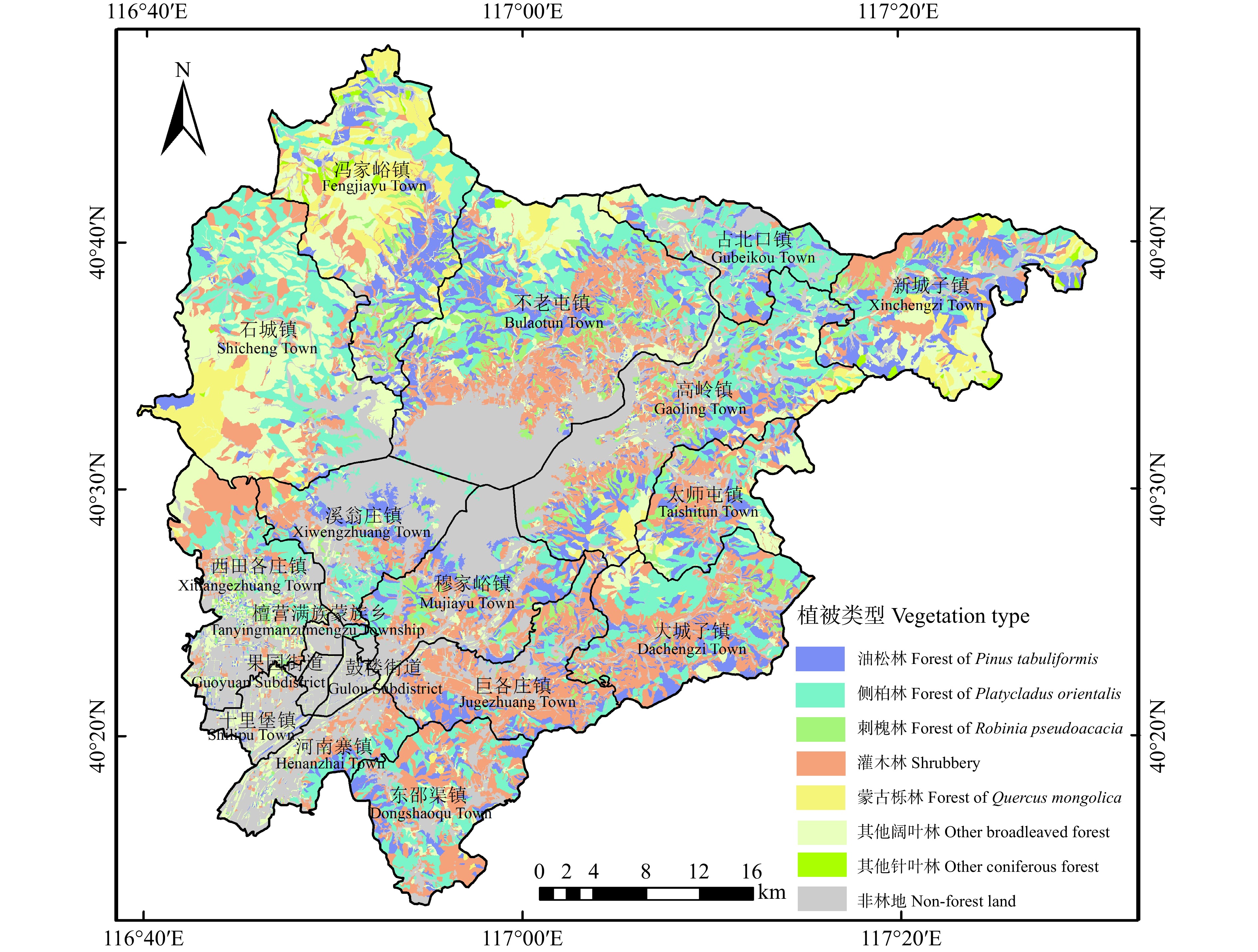
密云区是首批全国生态文明建设试点地区、首都重要饮用水源基地和生态涵养区,森林面积15.60万hm2,森林覆盖率达到70.13%,物种多样性丰富,生态区位极其重要。本研究以密云区为研究对象,利用2019年森林资源二类调查小班数据、可燃物数据、人口数据和重要火源点数据等,结合密云区森林防火实际情况,构建密云区森林火灾危险性评价体系,开展小班尺度森林火灾危险性评价,以期为密云区林火精准化防控与管理提供参考。
1. 研究区概况
密云区(40°13′07" ~ 40°47′57″N,116°39′33″ ~ 117°30′25″E)位于北京市东北部,属燕山山地与华北平原交接处,西北到东南依次与怀柔、顺义、平谷接壤,东部和北部均与河北省相邻,是首都面积最大的区。密云区面积达22.29万hm2,自然地貌特征为“八山一水一分田”,其中山区、平原、水域面积分别约为17.72万、2.63万、1.94万hm2,山区面积占全区面积4/5(图1)。辖区属暖温带季风型大陆性半湿润半干旱气候,年平均气温10.8 ℃,年日照时数2420 h,年降水量为608 mm,年积温介于3 385 ~ 4 210 ℃·d,土壤类型以褐土为主。全区森林资源丰富,森林资源蓄积量为全市最多,达252.79万m3。每年的11月1日至次年5月31日是森林防火期,1月1日至4月15日是森林高火险期。2019年3月30日,密云区东邵渠镇突发森林火灾,火情在风势较大的影响下向平谷区蔓延,总过火面积近42 hm2,丫髻山林场内大面积林木过火,生态损失严重。
2. 数据来源与研究方法
2.1 数据来源
2019年森林资源二类调查小班数据来自北京市园林绿化规划和资源监测中心;可燃物数据、人口数据和重要火源点数据来自密云区园林绿化局;30 m分辨率数字高程数据来自中国科学院计算机网络信息中心地理空间数据云平台(http://www.gscloud.cn);气象数据来自于北京市气象服务中心,为了能更好地根据气象数据进行危险性评价,基于前人研究[32],选取包括2011—2020年5个气象站点(密云、密云上甸子、汤河口、怀柔、平谷)防火期(11月—次年5月)月最高温度、月平均风速、月大风日数、月平均降水量、月平均气温、月最小相对湿度数据。利用克里金插值法对气象数据进行插值处理,并进行数据重采样,按掩膜提取为50 m分辨率栅格数据。
2.2 研究方法
2.2.1 森林火灾危险性评价指标体系的构建
通过对森林火灾危险的致灾因子分析,参考国内外森林火灾危险评价体系的研究成果,结合密云区森林防火实际情况,构建密云区森林火灾危险评价体系,该评价体系分为目标层、准则层、指标层,选取可燃物、气象条件、地形因子、野外火源4个因素作为火灾危险性评价的一级指标,参考前人有关火灾评价的相关文献以及《第一次全国自然灾害综合风险普查技术规范—森林火灾危险性评估技术规范》(FXPC/LC P-01)中的森林火灾危险性评估指标体系,针对性地选取15个二级指标评价火灾危险性,构建小班尺度森林火灾危险性评价指标体系(表1)[2,10−12]。
表 1 森林火灾危险性评价指标Table 1. Forest fire hazard assessment index准则层
Rule layer标准层
Standard layer描述
Description单位 Unit 森林可燃物
Forest fuel地表可燃物载量 Surface fuel load 单位面积灌木、草本、枯落物等可燃物的载量 Amount of surface fuel (shrub, herb, litter) per unit area t/hm2
t/ha细小可燃物载量 Fine fuel load 单位面积枯落物1(直径 < 0.6 cm 的小枝、叶和杂草)、枯落物2(直径0.6 ~ 2.5 cm的小枝、叶和杂草)等可燃物的载量 Total load of combustible materials such as litter 1 (twigs, leaves, and weeds with a diameter of less than 0.6 cm) and litter 2 (twigs, leaves, and weeds with a diameter of 0.6−2.5 cm) per unit area t/hm2
t/ha优势树种(组)可燃性 Dominant tree species (group) flammability 森林被引燃着火的难易程度以及着火后所表现出的燃烧状态和燃烧速度和火强度等的综合 Difficulty of forest ignition, as well as the combustion state (type of fire), combustion speed, and fire intensity exhibited after ignition 气象条件
Meteorological factor月大风日数 Monthly gale day 月平均出现瞬时风力5级或以上的天气日数 Monthly average number of weather days with instantaneous wind force 5 or above is expressed d 月平均风速 Monthly average wind speed 月每日平均风速的平均值 Average value of monthly daily average wind speed m/s 月平均降水量 Monthly mean precipitation 总降水量的月平均值 Monthly average of total rainfall mm 月平均气温 Monthly mean temperature 月每日平均气温的平均值Average daily temperature of the month ℃ 月最高温度 Monthly maximum temperature 月每日最高气温的最高值 The highest value of daily maximum temperature ℃ 月最小相对湿度 Monthly minimum relative humidity 月每日最小相对湿度的最小值 The minimum value of monthly daily minimum relative humidity % 野外火源
Outdoor fire source用火次数 Fire usage frequency 近20年,林区范围内发生的一般、较大森林火灾的总次数 Total number of general and major forest fires that have occurred within the forest area in the past 20 years 次数
times重要火源点个数 Number of important ignition source 林区范围内散坟、露营地、旅游景区、公墓、农村集体安葬点等火源点总数量 Total number of fire sources such as scattered graves, camping sites, tourist attractions, cemeteries, and rural collective burial sites within the forest area 无民事行为能力和限制民事行为能力人口数量 Number of people without or with limited capacity for civil conduct 林区范围内0 ~ 14岁人口、65岁(含)以上人口和残障人口总数量 Total number of people aged 0 − 14, aged 65 or above, and disabled within the forest area 地形因子
Topographical factor坡度 Slope 坡面的垂直高度和水平宽度的比值 Ratio of vertical height to
horizontal width of a slope(°) 坡向 Aspect 坡面的朝向 Orientation of slope 坡位 Slope position 坡面所处的地貌部位 Landform on which a slope is located 2.2.2 数据标准化及指标综合权重的确定
由于原始数据的量纲不同,需对其进行归一化处理,使数据分布在[0,1]。其中,优势树种(组)可燃性参照前人研究成果[33−34],划分为不燃、难燃、可燃、易燃、强燃5类,分别赋值为0.2、0.4、0.6、0.8、1.0;坡向和坡位指标采用《第一次全国自然灾害综合风险普查技术规范—森林火灾危险性评估技术规范》(FXPC/LC P-01)中的赋值方法;其他12个指标如月大风日数、月平均气温等采用离差标准化法进行处理,其中月最小相对湿度和月平均降水量进行负向标准化,其余指标进行正向标准化。正向标准化和负向标准化公式分别见式(1)和式(2)。
X′mn=Xmn−minXmnmaxXmn−minXmn (1) X′mn=maxXmn−XmnmaxXmn−minXmn (2) 式中:X′mn和Xmn分别为第m个因子第n个指标值的标准化值和原始值;maxXmn和minXmn分别为第i个指标原始数值中的最大值和最小值。
层次分析法是一种主观赋权法,指由多名专家根据经验对各层次指标进行“两两相对”重要性比较,构建判断矩阵并进行一致性检验,最终确定各等级的主观权重[35]。本研究依据全国火险区划等级[20]以及全国第一次森林火灾风险普查[2],共邀请68位专家进行综合打分从而确定层次分析法最终权重,其中防火管理专家组成员24人(占比35%),科研技术专家组成员33人(占比49%),基层一线防火专家组成员11人(占比16%)。熵权法是一种基于分析各评价指标特征值之间变异程度的客观赋权方法[36]。
为了全面反映评价指标的重要性,避免层次分析法中人为因素占主导作用,或熵权法中各指标与实际重要性存在矛盾,参考前人研究[37−38],将综合权重的确定运用简单加权求和,主观赋权法和客观赋权法各占50%(主客观赋权法),进而得到各指标综合权重。
2.2.3 森林火灾危险性指数计算及等级划分
加权综合评价法是考虑到各指标对于总体对象的影响程度,综合评价各影响指标的作用大小,从而实现对于总体的优劣评价,可将多个指标联系起来,具有系统性强、计算过程相对简单等优点[39]。利用加权综合评价法计算密云区小班尺度森林火灾危险性指数,具体计算公式如下。
HI=∑ni=1H′i×qi (3) 式中:HI为小班尺度森林火灾危险性指数;H′i为第i项指标的标准化值;qi为危险性指标体系中二级指标第i项指标的权重值。
自然断点分级法可通过评价区域内所有值与平均值之差找到特征点,从而对相似值进行分级。本研究采用上述方法将火灾危险性分为低、中低、中高、高4个等级[2]。
2.2.4 森林火灾危险性空间自相关性
采用全域的莫兰指数表征全局空间自相关性。
I=\frac{n\displaystyle\sum_{i=1}^n\displaystyle\sum_{j=1}^n\boldsymbol{w}_{ij}(x_i-\overline{x})(x_j-\overline{x})}{s^{2^{ }}\displaystyle\sum_{i=1}^n\displaystyle\sum_{j=1}^n\boldsymbol{w}_{ij}\displaystyle} (4) 式中:I为全域莫兰指数;n为空间内所有要素的总量;wij为空间距离矩阵;xi和xj分别为空间位置i和j的观察值。\overline x 表示所有观察值的平均值,s2为方差。I的取值范围为[−1,1],I小于0说明要素之间存在空间负相关,I等于0则表示要素之间相互独立,I大于0表示要素之间存在空间正相关[40]。
局部空间自相关采用局域莫兰指数进行分析。
{I_i} = \frac{{\left( {{x_i} - \overline x} \right)}}{{{s^2}}}\sum\nolimits_{j = 1}^n {{{\boldsymbol{w}}_{ij}}({x_j} - \overline x)} (5) 式中:Ii为局域莫兰指数,正值说明该要素与邻近要素的属性相似,负值说明该空间单元与邻近单元属性值不相似[41],通过局域空间自相关分析可以判断出聚集分布特征。
2.3 数据统计与分析
利用Excel 2019对各指标数据进行统计分析,采用ArcMap 10.7进行制图与自相关性分析。
3. 结果与分析
3.1 森林火灾危险性评价指标权重的确定
由专家打分即层次分析法确定的主观权重最终结果如下:可燃物所占权重为0.35,气象条件所占权重为0.28,野外火源所占权重0.26,地形因子所占权重0.11。
根据熵权法和层次分析法相结合的主客观赋权法,密云区森林火灾危险性评价指标权重结果见表2。
表 2 森林火灾危险性评价指标权重Table 2. Weights of forest fire hazard assessment index一级指标
Primary index一级指标
综合权重
Comprehensive
weight of first
level index二级指标
Secondary index二级指标
熵权法权重
Entropy weight
of secondary
index二级指标
层次分析法权重
Chromatography
analysis weight of
secondary index二级指标
综合权重
Comprehensive
weight of
secondary
index计算尺度
Computing scale森林可燃物
Forest fuel0.215 地表可燃物载量 Surface fuel load 0.020 0.110 0.065 小班
Subcompartment细小可燃物载量 Fine fuel load 0.040 0.140 0.090 小班
Subcompartment优势树种(组)可燃性
Dominant tree species (group) flammability0.020 0.100 0.060 小班
Subcompartment气象条件
Meteorological
factor0.245 月大风日数 Monthly gale day 0.050 0.050 0.050 小班
Subcompartment月平均风速
Monthly average wind speed0.040 0.040 0.040 小班
Subcompartment月平均降水量
Monthly mean precipitation0.030 0.060 0.045 小班
Subcompartment月平均气温
Monthly mean temperature0.040 0.040 0.040 小班
Subcompartment月最高温度
Monthly maximum temperature0.040 0.040 0.040 小班
Subcompartment月最小相对湿度
Monthly minimum relative humidity0.010 0.050 0.030 小班
Subcompartment野外火源
Outdoor fire source0.385 用火次数 Fire usage frequency 0.260 0.100 0.180 乡镇 Township 重要火源点数量
Number of important ignition sources0.130 0.100 0.115 乡镇 Township 无民事行为能力和限制民事行为能力人口数量 Number of people without or with limited capacity for civil conduct 0.120 0.060 0.090 乡镇 Township 地形因子
Topographical
factor0.155 坡度 Slope 0.140 0.040 0.090 小班
Subcompartment坡向 Aspect 0.030 0.040 0.035 小班
Subcompartment坡位 Slope position 0.030 0.030 0.030 小班
Subcompartment林火的发生受到可燃物、野外火源、气象因素和地形因子等各种因素的影响。由表2可知,森林火灾危险性评价体系的4个一级指标即可燃物、气象条件、野外火源、地形因子的综合权重分别为0.215、0.245、0.385、0.155,说明野外火源是影响森林火灾危险性的主要因素。二级指标中,用火次数和重要火源点数量2个二级指标的综合权重分别为0.180、0.115,说明用火次数和重要火源点数量是影响野外火源的主要因素;单位面积细小可燃物载量、无民事行为能力和限制民事行为能力人口数量及坡度的综合权重均为0.090,说明这3个二级指标对于火灾危险性的也有一定的影响。
3.2 基于小班尺度的森林火灾危险性评价结果
对选取的15个森林火灾危险性指标进行小班尺度加权综合计算,划分等级,得到密云区小班尺度森林火灾危险性等级图(图2)。
![]() 图 2 密云区小班尺度森林火灾危险性等级图Figure 2. Forest fire hazard level map at the sub-compartment scale in Miyun District
图 2 密云区小班尺度森林火灾危险性等级图Figure 2. Forest fire hazard level map at the sub-compartment scale in Miyun District高等级危险性小班分布在研究区范围的东部以及中南部区域,主要集中于巨各庄镇、高岭镇和新城子镇;中高等级危险性小班,其空间分布与高等级危险性小班分布区邻近,也有部分零星分布在研究区西北部,主要集中于大城子镇和古北口镇;中低等级与低等级危险性小班分布在研究区北部以及西南部城镇较密集的区域,其他区域也存在少量分布,主要集中于不老屯镇、河南寨镇和十里堡镇。
将密云区森林火灾危险性等级图与主要植被类型图进行综合分析(图3),发现灌木林主要分布在研究区的南部以及大部分高等级危险性区域,同时这些区域也有少量油松(Pinus tabuliformis)林和侧柏(Platycladus orientalis)林分布。进一步统计可知,高等级、中高等级、中低等级、低等级危险性的小班面积占比分别为12.75%、19.01%、41.70%、26.54%,其中,高等级危险性小班以灌木林、侧柏林、油松林为主,小班面积占比分别为38.40%、25.76%、24.13%。高等级危险性油松林以人工成熟林为主,小班面积占比为71.10%;高等级危险性侧柏林以人工幼龄林为主,小班面积占比达到88.51%。
3.3 密云区森林火灾危险性空间自相关性分析
进行空间自相关分析可以明确高等级危险性小班是否存在聚集分布,如存在,可探讨其聚集分布的区域。
对密云区各小班的火灾危险性进行全域空间自相关分析,结果显示小班火灾危险性的全域莫兰指数为0.2413,Z检验结果呈现极显著(P < 0.01),表明密云区小班的火灾危险性存在一定的正相关性,说明高等级危险性小班之间存在聚集分布的特征。
因此,对密云区小班的火灾危险性进行局域空间自相关分析,结果见图4。
![]() 图 4 火灾危险性局部空间自相关分析聚集图Figure 4. Aggregation diagram of local indicators of spatial association (LISA) of fire hazard
图 4 火灾危险性局部空间自相关分析聚集图Figure 4. Aggregation diagram of local indicators of spatial association (LISA) of fire hazard高−高聚集型小班2 234个,包括极显著聚集小班1 252个(P < 0.01)和显著聚集小班982个(P < 0.05);低−低聚集型小班2 374个,包括极显著聚集小班1 138个(P < 0.01)和显著聚集小班1 236个(P < 0.05);高−低聚集型小班1 572个,包括极显著聚集小班827个(P < 0.01)和显著聚集小班745个(P < 0.05);低−高聚集型小班612个,包括极显著聚集小班343个(P < 0.01)和显著聚集小班269个(P < 0.05)。进一步统计可知,火灾危险性的高−高聚集型小班面积达34 637.77 hm2,占所有小班的15.56%,主要分布在密云区东部以及中南部区域,从乡镇尺度分析,高−高聚集型小班集中分布在新城子镇、高岭镇和巨各庄镇。
4. 讨 论
森林火灾危险性评价是一个综合性强且复杂的问题,受众多因素的影响,评价指标具有时效性,且不同尺度的评价具有不同的评价结果,科学、合理的评价结果能够显示出研究区域当前的森林火灾危险性现状以及未来可能存在的隐患,对于开展林火防控具有现实指导意义。而基于小班尺度进行评价能够使研究从基本单元入手,提出针对性的建议,进一步进行大尺度分析;同时,评价结果有具体导向作用[42],不仅能极大提高防火的工作效率,而且对于提高防火管理精准性具有重要意义。例如,可以根据评价结果对高等级危险性区域或者其聚集区域采取更有力的措施,制定针对性的防火对策[43]。
本文构建的评价体系显示,各因子所占权重由大到小依次为:野外火源(0.385) > 气象因子(0.245) > 可燃物因子(0.215) > 地形因子(0.155),权重分布比例与前人研究结果相一致[44−45],因此,本研究建立的森林火灾危险性评价体系是合理、可供参考的。在本文构建的评价体系中,野外火源在森林火灾危险性所占权重最大,这与苏立娟等[46]和Catry等[47]的研究结果一致,本研究进一步发现二级指标中用火次数与重要火源点数量权重较大,分别为0.180和0.115。根据王武建等[48]和吕常笑等[49]的研究可知,绝大部分火灾都是人为因素造成,而研究中调查的重要火源点以散坟、露营地、旅游景区为主,人为因素较多,因此重要火源点占比较高;另一方面,以前发生过火灾的区域,可能属于人类活动较多的区域,因而用火次数在评价体系中同样所占权重较高。
此外,高等级危险性小班以灌木林、油松林、侧柏林为主,根据密云区森林植被图(图3),灌木林、油松林、侧柏林在密云区广泛分布,也可能是由于灌木林更靠近人类活动区域,火源点较多。同时,根据王秋华等[50]的研究可知,林下灌木在没有人为干扰的情形下,生长很快,一旦着火将会释放出巨大的能量,且由于灌木林分布连续、均一、致密,燃烧性和火行为不同于乔木林。因此,根据高等级危险区域的植被分布研究结果,建议定期对靠近火源点的可燃物进行及时清理,以减少森林火灾的发生。
局域空间自相关可以反映要素在局域内的空间分异特征和聚集特征[40]。本研究发现,高等级危险性小班分布在研究区范围的东部以及中南部区域,从乡镇尺度出发,呈片状分布于巨各庄镇、高岭镇和新城子镇;而局域空间自相关分析的结果表明,高−高聚集型小班同样集中于研究区范围的东部以及中南部区域,由中南部向东部呈带状延伸,从乡镇尺度出发,同样集中于巨各庄镇、高岭镇和新城子镇。两条结果综合显示:对于研究区东部以及中南部的小班区域,其危险性较大,且聚集程度高。这与李顺等[51]的研究结果一致,林火一般聚集在一些特定的林火高发区。对于这类区域,根据指标权重大小,一方面,建议全面落实野外火源的记录,增强对野外火源和重点人群的监督和管理;另一方面,制定可燃物清理的标准和要求,在农林交错地区和火源点周围进行定期可燃物清理作业。
本研究以密云区为研究对象,构建密云区森林火灾危险性评价体系,开展小班尺度森林火灾危险性评价,为密云区森林火灾精细化防控提供一定的理论依据。但由于森林火灾的发生成因较为复杂,其影响因子较多,分类也较复杂,要精确地进行森林火灾危险性评价存在较大的难度。为了保证数据获取的准确性,本研究仅基于用火次数、火源点数量及无民事行为能力人口数量来评价野外火源指标,但进山卡口、防火检查站的设置数量等指标并没有纳入评价体系,这些对于森林火灾的发生也有重要影响[52],此外,可燃物因子重点调查了地表火指标而没有考虑冠层火指标,但两者之间可以相互转换(垂直连续性),且冠层可燃物载量、冠层高度等对森林火灾的发生也具有重要影响[53]。因此,在今后的研究中还应进一步细化指标,考虑更多相关因子,在建立优化的评价体系、指标定量化确定、等级标准划分等方面,还需更为深入地研究,使评价结果更科学客观和准确。
5. 结 论
本研究以密云区为研究对象,基于2019年森林资源二类调查小班数据、森林可燃物数据、重要火源点等数据构建森林火灾危险性评价指标体系,评价结果可以为林火精细化管理和防控提供依据。研究结果表明:(1)构建的森林火灾危险性评价体系中,野外火源所占权重最大,是影响森林火灾危险性的主要因素;(2)高等级危险性小班区域灌木林占比较高,且聚集分布特征明显,根据权重结果,建议增强对野外火源和重点人群的监督和管理;另一方面,制定可燃物清理的标准和要求,定期在农林交错地区和火源点周围进行可燃物清理作业。
-
![]()
图 2 密云区小班尺度森林火灾危险性等级图
Figure 2. Forest fire hazard level map at the sub-compartment scale in Miyun District
![]()
图 4 火灾危险性局部空间自相关分析聚集图
Figure 4. Aggregation diagram of local indicators of spatial association (LISA) of fire hazard
表 1 森林火灾危险性评价指标
Table 1 Forest fire hazard assessment index
准则层
Rule layer标准层
Standard layer描述
Description单位 Unit 森林可燃物
Forest fuel地表可燃物载量 Surface fuel load 单位面积灌木、草本、枯落物等可燃物的载量 Amount of surface fuel (shrub, herb, litter) per unit area t/hm2
t/ha细小可燃物载量 Fine fuel load 单位面积枯落物1(直径 < 0.6 cm 的小枝、叶和杂草)、枯落物2(直径0.6 ~ 2.5 cm的小枝、叶和杂草)等可燃物的载量 Total load of combustible materials such as litter 1 (twigs, leaves, and weeds with a diameter of less than 0.6 cm) and litter 2 (twigs, leaves, and weeds with a diameter of 0.6−2.5 cm) per unit area t/hm2
t/ha优势树种(组)可燃性 Dominant tree species (group) flammability 森林被引燃着火的难易程度以及着火后所表现出的燃烧状态和燃烧速度和火强度等的综合 Difficulty of forest ignition, as well as the combustion state (type of fire), combustion speed, and fire intensity exhibited after ignition 气象条件
Meteorological factor月大风日数 Monthly gale day 月平均出现瞬时风力5级或以上的天气日数 Monthly average number of weather days with instantaneous wind force 5 or above is expressed d 月平均风速 Monthly average wind speed 月每日平均风速的平均值 Average value of monthly daily average wind speed m/s 月平均降水量 Monthly mean precipitation 总降水量的月平均值 Monthly average of total rainfall mm 月平均气温 Monthly mean temperature 月每日平均气温的平均值Average daily temperature of the month ℃ 月最高温度 Monthly maximum temperature 月每日最高气温的最高值 The highest value of daily maximum temperature ℃ 月最小相对湿度 Monthly minimum relative humidity 月每日最小相对湿度的最小值 The minimum value of monthly daily minimum relative humidity % 野外火源
Outdoor fire source用火次数 Fire usage frequency 近20年,林区范围内发生的一般、较大森林火灾的总次数 Total number of general and major forest fires that have occurred within the forest area in the past 20 years 次数
times重要火源点个数 Number of important ignition source 林区范围内散坟、露营地、旅游景区、公墓、农村集体安葬点等火源点总数量 Total number of fire sources such as scattered graves, camping sites, tourist attractions, cemeteries, and rural collective burial sites within the forest area 无民事行为能力和限制民事行为能力人口数量 Number of people without or with limited capacity for civil conduct 林区范围内0 ~ 14岁人口、65岁(含)以上人口和残障人口总数量 Total number of people aged 0 − 14, aged 65 or above, and disabled within the forest area 地形因子
Topographical factor坡度 Slope 坡面的垂直高度和水平宽度的比值 Ratio of vertical height to
horizontal width of a slope(°) 坡向 Aspect 坡面的朝向 Orientation of slope 坡位 Slope position 坡面所处的地貌部位 Landform on which a slope is located  下载: 导出CSV
表 2 森林火灾危险性评价指标权重
Table 2 Weights of forest fire hazard assessment index
一级指标
Primary index一级指标
综合权重
Comprehensive
weight of first
level index二级指标
Secondary index二级指标
熵权法权重
Entropy weight
of secondary
index二级指标
层次分析法权重
Chromatography
analysis weight of
secondary index二级指标
综合权重
Comprehensive
weight of
secondary
index计算尺度
Computing scale森林可燃物
Forest fuel0.215 地表可燃物载量 Surface fuel load 0.020 0.110 0.065 小班
Subcompartment细小可燃物载量 Fine fuel load 0.040 0.140 0.090 小班
Subcompartment优势树种(组)可燃性
Dominant tree species (group) flammability0.020 0.100 0.060 小班
Subcompartment气象条件
Meteorological
factor0.245 月大风日数 Monthly gale day 0.050 0.050 0.050 小班
Subcompartment月平均风速
Monthly average wind speed0.040 0.040 0.040 小班
Subcompartment月平均降水量
Monthly mean precipitation0.030 0.060 0.045 小班
Subcompartment月平均气温
Monthly mean temperature0.040 0.040 0.040 小班
Subcompartment月最高温度
Monthly maximum temperature0.040 0.040 0.040 小班
Subcompartment月最小相对湿度
Monthly minimum relative humidity0.010 0.050 0.030 小班
Subcompartment野外火源
Outdoor fire source0.385 用火次数 Fire usage frequency 0.260 0.100 0.180 乡镇 Township 重要火源点数量
Number of important ignition sources0.130 0.100 0.115 乡镇 Township 无民事行为能力和限制民事行为能力人口数量 Number of people without or with limited capacity for civil conduct 0.120 0.060 0.090 乡镇 Township 地形因子
Topographical
factor0.155 坡度 Slope 0.140 0.040 0.090 小班
Subcompartment坡向 Aspect 0.030 0.040 0.035 小班
Subcompartment坡位 Slope position 0.030 0.030 0.030 小班
Subcompartment
下载: 导出CSV
-
[1] 胡源, 赵凤君, 陈锋, 等. 气候变暖及大尺度气候波动对全球林火与森林碳排放的影响[J]. 陆地生态系统与保护学报, 2021, 1(1): 75−81. Hu Y, Zhao F J, Chen F, et al. Impacts of global warming and large-scale climate fluctuation on forest fires and forest carbon emissions[J]. Terrestrial Ecosystem and Conservation, 2021, 1(1): 75−81.
[2] 国务院第一次全国自然灾害综合风险普查领导小组办公室. 森林和草原火灾风险调查与评估[M]. 北京: 应急管理出版社, 2021. Office of the Leading Group for the First National Comprehensive Survey of Natural Disaster Risks under The State Council. Forest and grassland fire risk investigation and assessment[M]. Beijing: Emergency Management Press, 2021.
[3] Shu H, Qi S, Ning N, et al. Risk assessment of debris flow disaster: a case study of Wudu District in the south of Gansu Province, China[J]. Journal of Natural Disasters, 2016, 25(6): 34−41.
[4] Yukili L. Forest fire hazard rating assessment mapping in Sabah, Malaysia[D]. Subang Jaya: Universiti Putra Malaysia, 2015.
[5] 范晨. 基于GIS的森林火灾风险评价的分析与研究[D]. 北京: 北京交通大学, 2010. Fan C. Analysis and research on forest fire risk assessment based on GIS [D]. Beijing: Beijing Jiaotong University, 2010.
[6] Dvornik A A, Dvornik A M, Kurilenko R S, et al. Mapping of forest fire hazard depending on weather conditions using geoinformation technologies[J]. Proceedings of the National Academy of Sciences, 2021, 66(3): 320−332.
[7] Mitsopoulos I, Trapatsas P, Xanthopoulos G. SYPYDA: a software tool for fire management in Mediterranean pine forests of Greece[J]. Computers and Electronics in Agriculture, 2016, 121: 195−199. doi: 10.1016/j.compag.2015.12.011
[8] Walding N G, Williams H T P, McGarvie S, et al. A comparison of the US National Fire Danger Rating System (NFDRS) with recorded fire occurrence and final fire size[J]. International Journal of Wildland Fire, 2018, 27(2): 99−113. doi: 10.1071/WF17030
[9] 林业部森林防火办公室. 全国森林火险区划等级:LY 1063—1992[S]. 北京: 中华人民共和国林业部, 1992. Forest Fire Prevention Office of the Ministry of Forestry. National forest fire risk zoning level: LY 1063−1992[S]. Beijing: Ministry of Forestry of the PRC, 1992.
[10] Krueger E S, Ochsner T E, Quiring S M, et al. Measured soil moisture is a better predictor of large growing-season wildfires than the Keetch–Byram drought index[J]. Soil Science Society of America Journal, 2017, 81(3): 490−502. doi: 10.2136/sssaj2017.01.0003
[11] 胡海清, 罗斯生, 罗碧珍, 等. 森林可燃物含水率及其预测模型研究进展[J]. 世界林业研究, 2017, 30(3): 64−69. Hu H Q, Luo S S, Luo B Z, et al. Forest fuel moisture content and its prediction model[J]. World Forestry Research, 2017, 30(3): 64−69.
[12] You W, Lin L, Wu L, et al. Geographical information system-based forest fire risk assessment integrating national forest inventory data and analysis of its spatiotemporal variability[J]. Ecological Indicators, 2017, 77: 176−184. doi: 10.1016/j.ecolind.2017.01.042
[13] 蒋春颖, 杨雪清, 张国丽, 等. 森林火灾风险评估技术体系探讨[J]. 林业资源管理, 2023(2): 17−26. Jiang C Y, Yang X Q, Zhang G L, et al. Discussion on the technical system of forest fire risk assessment[J]. Forest Resources Management, 2023(2): 17−26.
[14] Xie M X, Wang J Y, Yang A M, et al. DPSIR model-based evaluation index system for geographic national conditions[J]. Wuhan University Journal of Natural Sciences, 2017, 22(5): 402−410. doi: 10.1007/s11859-017-1265-y
[15] 牛若芸, 翟盘茂, 孙明华. 森林火险气象指数及其构建方法回顾[J]. 气象, 2006, 32(12): 3−9. doi: 10.3969/j.issn.1000-0526.2006.12.001 Niu R Y, Zhai P M, Sun M H. Review of forest fire danger weather indexes and their calculation methods[J]. Meteorological Monthly, 2006, 32(12): 3−9. doi: 10.3969/j.issn.1000-0526.2006.12.001
[16] 田晓瑞, 舒立福, 王明玉, 等. 利用Keetch-Byram干旱指数预测森林火险[J]. 火灾科学, 2003, 12(3): 151−155. doi: 10.3969/j.issn.1004-5309.2003.03.005 Tian X R, Shu L F, Wang M Y, et al. Using the Keetch-Byram drought index to predict forest fire risk[J]. Fire Safety Science, 2003, 12(3): 151−155. doi: 10.3969/j.issn.1004-5309.2003.03.005
[17] Cohen J D, Deeming J E. The national fire-danger rating system: basic equations[R]. Berkeley, CA: Pacific Southwest Forest and Range Experiment Station, 1985.
[18] 舒立福, 张小罗, 戴兴安, 等. 林火研究综述(Ⅱ): 林火预测预报[J]. 世界林业研究, 2003, 16(4): 34−37. doi: 10.3969/j.issn.1001-4241.2003.04.007 Shu L F, Zhang X L, Dai X A, et al. Forest fire research(Ⅱ): fire forecast[J]. World Forestry Research, 2003, 16(4): 34−37. doi: 10.3969/j.issn.1001-4241.2003.04.007
[19] 丽娜. 气候变化背景下内蒙古草原火灾风险动态评价与预估研究[D]. 长春: 东北师范大学, 2021. Li N. Dynamic risk assessment and prediction of grassland fire disaster in Inner Mongolia under climate change[D]. Changchun: Northeast Normal University, 2021.
[20] 国家林业局森林防火指挥部办公室. 全国森林火险区划等级: LY/T 1063—2008[S]. 北京:国家林业局, 2008. Office of the Forest Fire Prevention Headquarters of the State Forestry Administration. National forest fire risk zoning level. LY/T 1063−2008[S]. Beijing: State Forestry Administration, 2008.
[21] 陈羚, 陈锋, 牛树奎, 等. 北京鹫峰景观格局空间特征与森林火险的关联分析[J]. 北京林业大学学报, 2021, 43(6): 41−49. doi: 10.12171/j.1000-1522.20180431 Chen L, Chen F, Niu S K, et al. Correlation analysis between the spatial characteristics of landscape pattern and risk of forest fire in Jiufeng Forest Park of Beijing[J]. Journal of Beijing Forestry University, 2021, 43(6): 41−49. doi: 10.12171/j.1000-1522.20180431
[22] 宗学政, 田晓瑞, 刘畅. 林分尺度上的森林火灾风险评估方法及应用[J]. 林业科学研究, 2021, 34(5): 69−78. Zong X Z, Tian X R, Liu C. Forest fire risk assessment methods and applications at the stand scale[J]. Forest Research, 2021, 34(5): 69−78.
[23] 吴明山, 周汝良, 张明莎, 等. 林分尺度上的森林火险动态评估[J]. 林业资源管理, 2020(2): 126−134. Wu M S, Zhou R L, Zhang M S, et al. A dynamic assessment of forest fire risk on stand scale[J]. Forest Resources Management, 2020(2): 126−134.
[24] 罗丹, 王庆飞, 晁碧霄, 等. 广州市森林和城镇交界域林分尺度上的火险等级评价[J]. 林业资源管理, 2023(3): 56−64. Luo D, Wang Q F, Zhao B X, et al. Evaluation on fire risk rating of forest stand in wildland-urban interface: a case study of Guangzhou City[J]. Forest Resources Management, 2023(3): 56−64.
[25] Goldarag Y J, Mohammadzadeh A, Ardakani A S. Fire risk assessment using neural network and logistic regression[J]. Journal of the Indian Society of Remote Sensing, 2016, 44(6): 885−894. doi: 10.1007/s12524-016-0557-6
[26] Choi M Y, Jun S. Fire risk assessment models using statistical machine learning and optimized risk indexing[J/OL]. Applied Sciences, 2020, 10(12): 4199[2023−08−30]. https://www.mdpi.com/2076-3417/10/12/4199.
[27] Vilà-Vilardell L, Keeton W S, Thom D, et al. Climate change effects on wildfire hazards in the wildland-urban-interface–Blue pine forests of Bhutan[J/OL]. Forest Ecology and Management, 2020, 461: 117927[2023−08−30]. https://www.sciencedirect.com/science/article/abs/pii/S0378112719319024.
[28] 宗学政, 田晓瑞, 马帅, 等. 基于火模拟的森林火灾风险定量评估: 以中国林业科学研究院亚热带林业实验中心为例[J]. 北京林业大学学报, 2022, 44(9): 83−90. doi: 10.12171/j.1000-1522.20210328 Zong X Z, Tian X R, Ma S, et al. Quantitative assessment for forest fire risk based on fire simulation: taking the subtropical forest experimental center of Chinese Academy of Forestry as an example[J]. Journal of Beijing Forestry University, 2022, 44(9): 83−90. doi: 10.12171/j.1000-1522.20210328
[29] 张恒, 王轩, 张鑫, 等. 内蒙古赤峰市森林火险等级评价及火灾危险性评估[J]. 西南林业大学学报(自然科学), 2019, 39(2): 143−150. Zhang H, Wang X, Zhang X, et al. Forest fire danger rating and fire hazard assessment in Chifeng City of Inner Mongolia[J]. Journal of Southwest Forestry University (Natural Science), 2019, 39(2): 143−150.
[30] 陈羚. 北京市妙峰山林场景观安全与火灾危险性研究[D]. 北京: 北京林业大学, 2019. Chen L. Study on pattern of landscape security and fire hazard in Miaofengshan Mountain Forest Farm, Beijing [D]. Beijing: Beijing Forestry University, 2019.
[31] 周长明, 齐海超, 魏帅, 等. 基于GIS与AHP的黑龙江大兴安岭森林雷击火危险性划分[J]. 黑龙江气象, 2021, 38(3): 33−35. Zhou C M, Qi H C, Wei S, et al. Classification of forest lightning fire risk in the Greater Xing’an Mountains of Heilongjiang Province based on GIS and AHP[J]. Heilongjiang Meteorology, 2021, 38(3): 33−35.
[32] 王博, 杨雪清, 蒋春颖, 等. 基于GIS的北京市延庆区森林火灾蔓延风险[J]. 林业科学, 2023, 59(8): 90−101. Wang B, Yang X Q, Jiang C Y, et al. Forest fire spread risk in Yanqing District of Beijing based on GIS[J]. Scientia Silvae Sinicae, 2023, 59(8): 90−101.
[33] 鲁绍伟, 余新晓, 刘凤芹, 等. 北京八达岭林场森林燃烧性及防火措施研究[J]. 北京林业大学学报, 2006, 28(3): 109−114. doi: 10.3321/j.issn:1000-1522.2006.03.019 Lu S W, Yu X X, Liu F Q, et al. Forest fuel combustibility and methods for fire prevention at the Badaling Forest Farm, Beijing[J]. Journal of Beijing Forestry University, 2006, 28(3): 109−114. doi: 10.3321/j.issn:1000-1522.2006.03.019
[34] 牛树奎, 崔国发, 雷鸣, 等. 北京喇叭沟门林区森林燃烧性及防火区研究[J]. 北京林业大学学报, 2000, 22(4): 109−112. doi: 10.3321/j.issn:1000-1522.2000.04.020 Niu S K, Cui G F, Lei M, et al. Study on the forest combustibility and the fire districts in Labagoumen Forest region[J]. Journal of Beijing Forestry University, 2000, 22(4): 109−112. doi: 10.3321/j.issn:1000-1522.2000.04.020
[35] 周玉祥, 赵玉, 聂仁东, 等. 下辽河平原土地沙漠化程度及预测研究[J]. 生态环境学报, 2023, 32(6): 1133−1139. Zhou Y X, Zhao Y, Nie R D, et al. Characterization and prediction of land desertification in the lower Liaohe River Plain[J]. Ecology and Environmental Sciences, 2023, 32(6): 1133−1139.
[36] 徐建华. 现代地理学中的数学方法[M]. 北京: 高等教育出版社, 2004. Xu J H. Mathematical methods in modern geography[M]. Beijing: Higher Education Press, 2004.
[37] 孙朝锋, 吴立, 黄川容, 等. 基于GIS的福建省塑料大棚风害风险评估与区划[J]. 气象与环境科学, 2022, 45(4): 67−73. Sun C F, Wu L, Huang C R, et al. Risk assessment and zoning of wind damage in plastic greenhouses in Fujian Province based on GIS[J]. Meteorological and Environmental Science, 2022, 45(4): 67−73.
[38] 王娟, 牛晓宇, 孙亚玲. 甘肃省黑河中游段河流生态系统健康评价[J]. 陕西水利, 2023(9): 80−83. Wang J, Niu X Y, Sun Y L. Health evaluation of river ecosystem in the middle reaches of Heihe River in Gansu Province[J]. Shaanxi Water Resources, 2023(9): 80−83.
[39] 李洁, 郭梦晓, 高雯珂. 基于GIS的河南省洪涝灾害风险评估[J]. 现代农业科技, 2023, 837(7): 149−152, 158. Li J, Guo M X, Gao W K. Assessment of flood disaster risk in Henan Province based on GIS[J]. Modern Agricultural Sciences and Technology, 2023, 837(7): 149−152, 158.
[40] 邬建国. 景观生态学: 格局、过程、尺度与等级[M]. 2版. 北京: 高等教育出版社, 2007. Wu J G. Landscape ecology: patterns, processes, scales, and levels[M]. 2nd ed. Beijing: Higher Education Press, 2007.
[41] Anselin L. Local indicators of spatial association—LISA[J]. Geographical Analysis, 1995, 27(2): 93−115. doi: 10.1111/j.1538-4632.1995.tb00338.x
[42] 侯丽丽, 都瓦拉, 银山, 等. 基于牧户尺度的草原火灾风险评价: 以东乌珠穆沁旗为例[J]. 草业学报, 2021, 30(5): 1−12. doi: 10.11686/cyxb2020200 Hou L L, Duwala, Yin S, et al. Risk assessment of grassland fires at the herder scale: the Dongwuzhumuqin Banner as an example[J]. Acta Prataculturae Sinica, 2021, 30(5): 1−12. doi: 10.11686/cyxb2020200
[43] 安佳怡, 冯仲科, 马天天, 等. 基于GIS格网的重庆合川区森林火险等级区划[J]. 中南林业科技大学学报, 2022, 42(9): 91−101. An J Y, Feng Z K, Ma T T, et al. Zoning of forest fire risk levels in the Hechuan District of Chongqing based on GIS grid[J]. Journal of Central South University of Forestry & Technology, 2022, 42(9): 91−101.
[44] 王露秋. 基于GIS技术的洪雅县森林火险等级区划[D]. 成都: 四川农业大学, 2018. Wang L Q. Classification of forest fire risk in Hongya County based on GIS technology[D]. Chengdu: Sichuan Agricultural University, 2018.
[45] 张志强, 殷继艳. 西南高山林区森林火灾风险评价研究[J]. 中国应急救援, 2021(5): 30−35. Zhang Z Q, Yin J Y. Research on forest fire risk assessment in high mountain forest areas in Southwest China[J]. China Emergency Rescue, 2021(5): 30−35.
[46] 苏立娟, 何友均, 陈绍志. 1950—2010年中国森林火灾时空特征及风险分析[J]. 林业科学, 2015, 51(1): 88−96. Su L J, He Y J, Chen S Z. Temporal and spatial characteristics and risk analysis of forest fires in China from 1950 to 2010[J]. Scientia Silvae Sinicae, 2015, 51(1): 88−96.
[47] Catry F X, Rego F C, Bacao F, et al. Modeling and mapping wildfire ignition risk in Portugal[J]. International Journal of Wildland Fire, 2009, 18(8): 921−931. doi: 10.1071/WF07123
[48] 王武建. 2001—2016年安徽省森林火灾发生的时间趋势及火源特征[J]. 现代农业科技, 2023(17): 131−133, 138. doi: 10.3969/j.issn.1007-5739.2023.17.034 Wang W J. The time trend and fire source characteristics of forest fires in Anhui Province from 2001 to 2016[J]. Modern Agricultural Science and Technology, 2023(17): 131−133, 138. doi: 10.3969/j.issn.1007-5739.2023.17.034
[49] 吕常笑, 秦乃花, 李萍, 等. 山东省森林火灾时空分布及火源特征研究[J]. 森林防火, 2023, 41(2): 1−6. Lü C X, Qin N H, Li P, et al. Study on the spatiotemporal distribution and fire source characteristics of forest fires in Shandong Province[J]. Journal of Wildland Fire Science, 2023, 41(2): 1−6.
[50] 王秋华, 肖慧娟, 徐盛基, 等. 滇中安宁“3·29”重大森林火灾火烧迹地灌木林的燃烧性研究[J]. 安全与环境学报, 2016, 16(1): 138−141. Wang Q H, Xiao H J, Xu S J, et al. A study on the burning characteristics of shrubs in the “3.29” major forest fire in Anning, Central Yunnan[J]. Journal of Safety and Environment, 2016, 16(1): 138−141.
[51] 李顺, 吴志伟, 梁宇, 等. 大兴安岭林火发生的时空聚集性特征[J]. 生态学杂志, 2017, 36(1): 198−204. Li S, Wu Z W, Liang Y, et al. The temporal and spatial clustering characteristics of forest fires in the Great Xing’an Mountains[J]. Chinese Journal of Ecology, 2017, 36(1): 198−204.
[52] 肖良成, 刘同香, 蔡玉轩. 基于CRITIC的野外火源因素的重要度分析[J]. 林业科技通讯, 2022(12): 47−49. Xiao L C, Liu T X, Cai Y X. Importance analysis of field fire source factors based on CRITIC technical research[J]. Forest Science and Technology, 2022(12): 47−49.
[53] Reiner A L, Baker C, Wahlberg M, et al. Region-specific remote-sensing models for predicting burn severity, basal area change, and canopy cover change following fire in the southwestern United States[J/OL]. Fire, 2022, 5(5): 137[2023−09−10]. https://doi.org/10.3390/fire5050137.
-
期刊类型引用(2)
1. 王博,杨雪清,蒋春颖,赖光辉,陈锋,刘晓东. 北京山区森林火灾蔓延风险评估. 生态学报. 2025(02): 813-821 .  百度学术
百度学术
2. 律江,贾玮,刘洋,刘阳. 城市与森林融合的国有林场森林防火地面防控新范式探索——以北京市西山试验林场为例. 森林防火. 2024(03): 42-45 . 百度学术
其他类型引用(0)


计量
- 文章访问数: 462
- HTML全文浏览量: 70
- PDF下载量: 74
- 被引次数: 2
